Conflict Urbanism
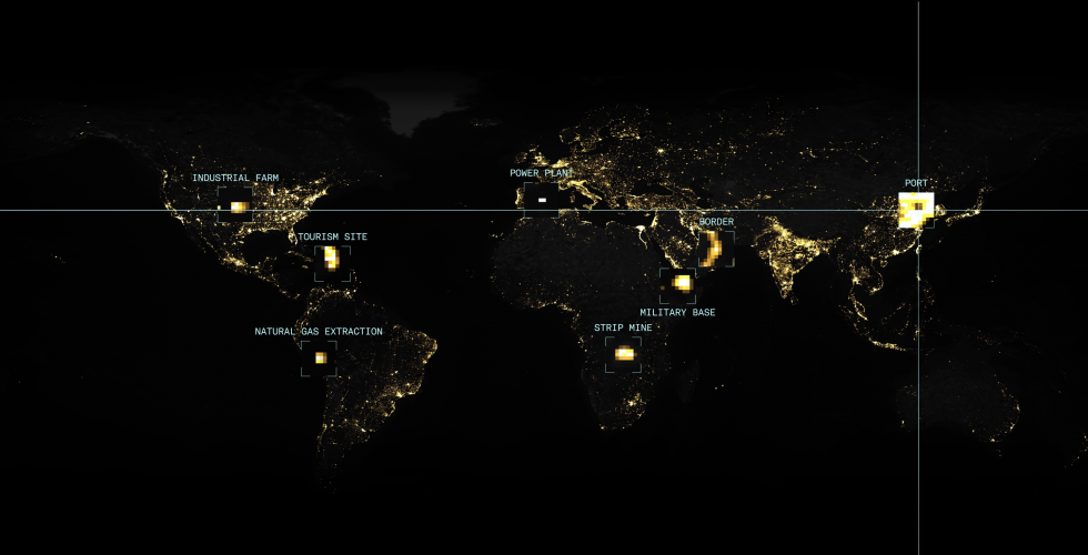

Conflict Urbanism as a term designates not simply that conflict that take place in cities, but also that conflict is a structuring principle of cities, as a way of inhabiting and creating urban space. The theme is topical in light of the increasing urbanization of warfare and the policing and surveillance of everyday life, however, conflict is not limited to war and violence. Cities are not only destroyed but also built through conflict. Our seminar will look at the ways in which cities have long been arenas of friction, difference, and dissidence, as well as the ways in which their irreducibly conflictual character manifests itself in everything from neighborhood borders, to differences of opinion and status, to ordinary encounters on the street. Student work in Conflict Urbanism will take place through a single city or by comparing a series of cities examining the role of conflicts of all sorts play in the making and remaking of cities around the world. Conflicts can (and should) be investigated with maps and data, but they often turn out to be propelled or propagated by them as well. Bringing humanistic inquiry together with spatial data and basic mapping techniques will allow us to produce powerful representations as well as challenge conventional narratives of cities and conflict today. Cities will be “seen” through a number of lenses including: mass incarceration, infrapolitics, urbanization of war, language ecology, migration(political, economic and climate), debt, algorithms and surveillance.
Students will be required to read assigned texts and discuss these in seminars each week. For a semester long project, work will be multi-media. Each project will center around critical and counter cartographies: mapping as a creative and analytic research tool. For the final assignment, students will create a map(web-based or a series of static images) as well as written reflections, incorporating analogue as well as digital media. For students with no expertise in mapping, this course can be paired with A4407-1, Methods in Spatial Research. Students may take the course for 1.5 credits, or audit and complete all labs related to their work in the seminar.
ARCH A4890 - 3 Credits
Monday 11am-1pm
Call number: 11405
Instructor: Laura Kurgan, Professor of Architecture
Open to students within GSAS, GSAPP, Barnard and Columbia Colleges, and others by permission.
Each semester students in the course produce an online publication of their final projects.
2023: Conflict Urbanism student work
2022: Conflict Urbanism student work
2021: Conflict Urbanism student work
2020: Conflict Urbanism student work
2019: Conflict Urbanism: Puerto Rico Now student work
2017 Fall: Conflict Urbanism: Infrapolitics student work
2017 Spring: Conflict Urbanism: Language Justice student work