Mapping for Architecture, Urbanism and the Humanities
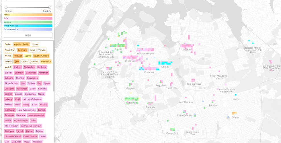
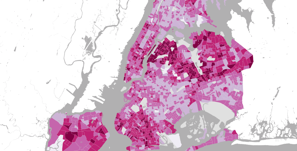
We are in the midst of a technological revolution, resulting in seemingly endless amounts of data and the computing technologies to analyze it. From motion sensing to location tracking to GIS, much of this data is spatial, resulting in the ability to represent and understand the world and our relationship to in in new and previously impossibly ways. In response, our relationship to the spaces we inhabit and those that we don't has shifted: we are challenged to make sense of spaces we have never visited, and deeply analyze those that we frequent. This course provides an introduction to critical mapping theory and geographic information systems tools. Of particular interest to Humanities students, we will address both historical and contemporary questions of space and mapping. Through the use of open-source GIS software (qGIS) and open data (OpenStreetMap) students will learn how to critically use mapping tools and geographic data for spatial analysis and representation. In addition to using existing data, students will also be able to create or bring their own sets of data and questions from other courses and will be able to work with these in our class. Using a hybrid flipped-classroom/seminar approach, students will work through web tutorials and hands-on in-class exercises to gain a better understanding of how these tools and data can be leveraged to analyze, represent and study past or present urban phenomena.