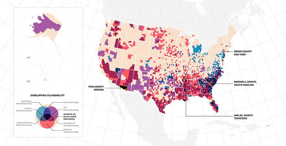
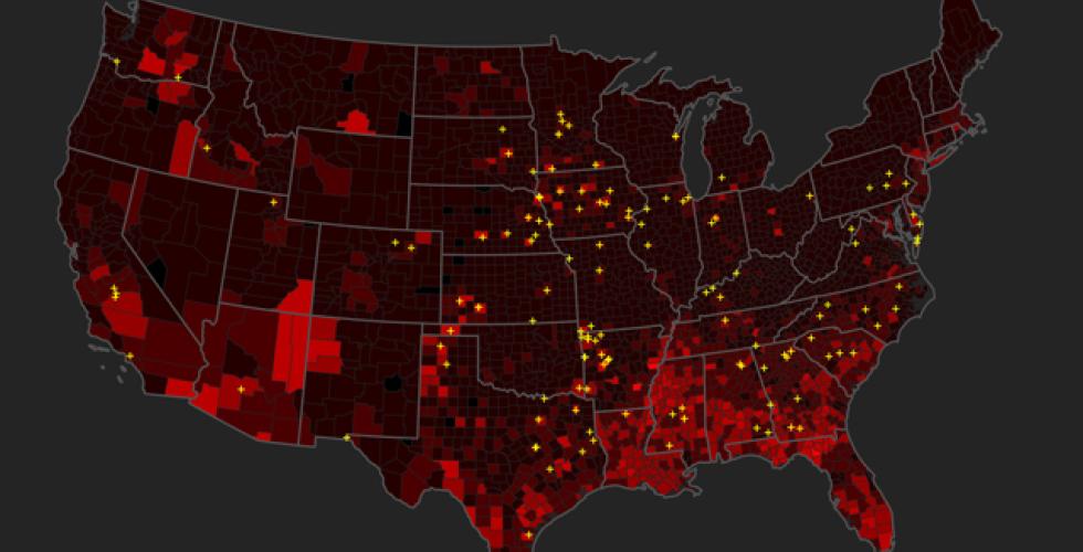
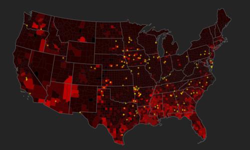
Over the summer of 2020, researchers at the CSR investigated patterns in the distribution of COVID-19 while critically questioning the role of mapping and data visualization in understanding the pandemic. The research sought to match the COVID-19 count data at the county level with various other datasets to spatially explore patterns and trends in the spread of the virus across multiple scales.
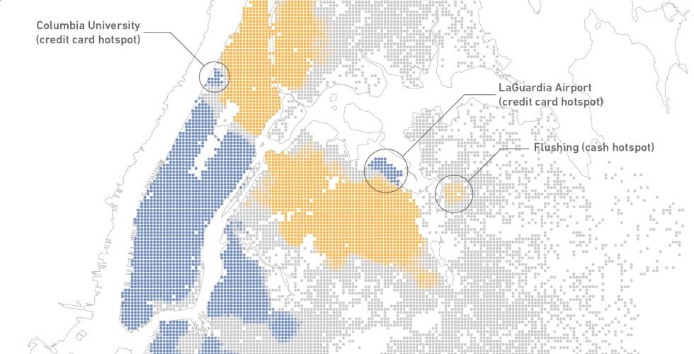
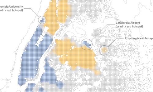
Access to Taxicabs for Unbanked Households: An Exploratory Analysis in New York City
In this paper, we used multiple datasets to explore taxicab fare payments by neighborhood and examine how paid taxicab fares are associated with use of conventional banking services. There are clear spatial dimensions of the propensity of riders to pay cash, and we found that both immigrant status and being “unbanked” are strong predictors of cash transactions. These results have implications for local regulations of the for-hire vehicle industry, particularly in the context of the rapid growth of services that require credit cards to use.