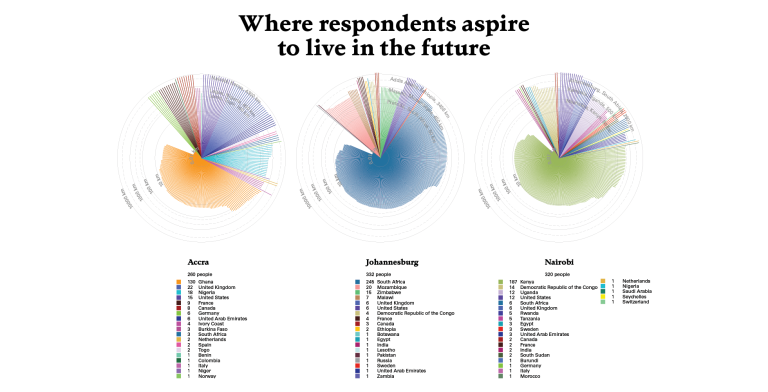
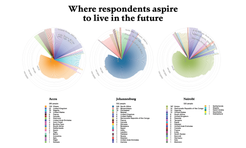
In an era of increased fluidity, political devolution, institutional fragmentation, and economic and environmental precarity, African cities are reshaping under a young population preparing for uncertain futures. This project seeks to understand the emerging patterns of human mobility, urbanism, and socio-political changes through extensive surveys in Accra, Nairobi, and Johannesburg, conducted by the African Centre for Migration and Society (ACMS). It visualizes residents' connections to place and captures the intricacies of their fragmented and uncertain lives. This research, in collaboration with the University of the Witwatersrand, aims to generate data for further academic exploration, policy reconsideration, and to enhance understanding of spatial inequality and future politics in Africa.
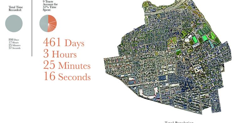
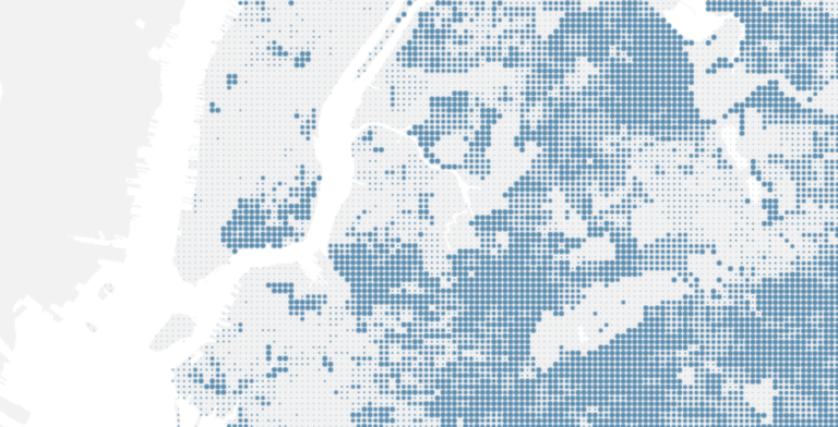
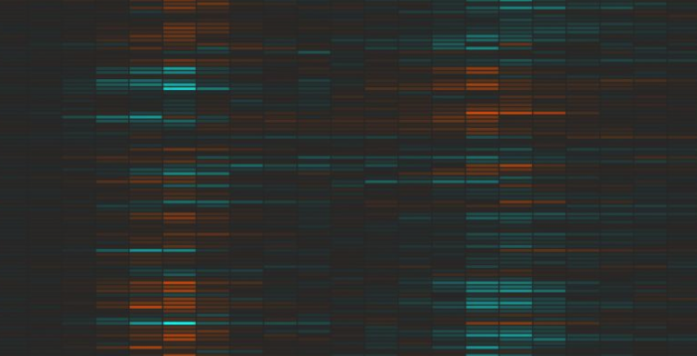
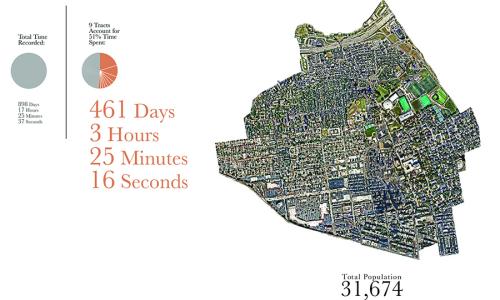
This project visualizes the U.S. Census through the lens of 1 person’s location data over the course of 3 years. It addresses the potential of self quantification in the personalization of public aggregate data. We are constantly viewed through data collected from us. However, despite the increasing nuance and sophistication of classification and categorization systems, the formalization of categories is always going to be playing catch up to how we can define ourselves. Is it possible that we can challenge the transactional nature of our current relationship with data by viewing aggregate data through the lens of self knowledge?
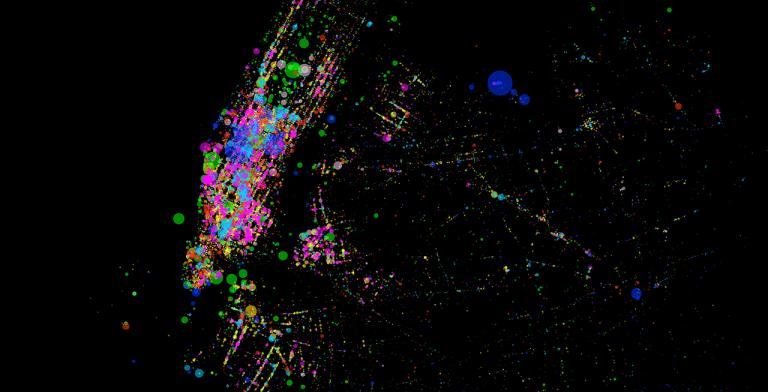
We Can is a multimedia storytelling project that explores the lives and activity of canners, people who pick up cans and bottles on NYC streets. We combined oral history, manual data collection, mapping and illustration to encourage a more critical observation of a community and its subculture. The mapping component consists in GPS tracked canners’ daily itineraries that unfold, while revealing the quantitative and qualitative data collected manually.
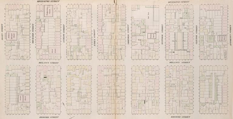
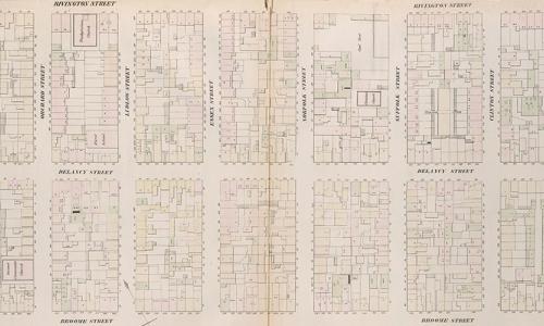
Mapping Historical New York: A Digital Atlas visualizes Manhattan’s and Brooklyn’s transformations during the late-nineteenth and early-twentieth centuries. Drawing on 1850, 1880, and 1910 census data, it shows how migration, residential, and occupational patterns shaped the city.
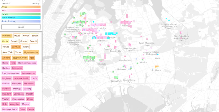
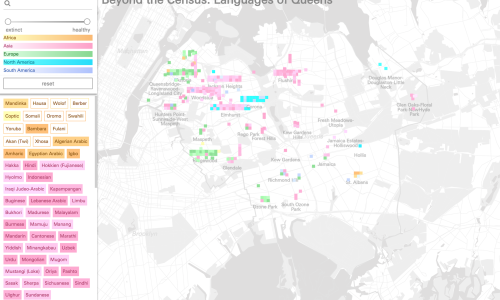
Conflict Urbanism: Language Ecologies explores the role that language plays in shaping urban space. Language interacts with its environment at multiple scales and with diverse media. As an ecology, language either dominates, or is vulnerable to its host environments. In this way it often makes conflict visible in urban settings.
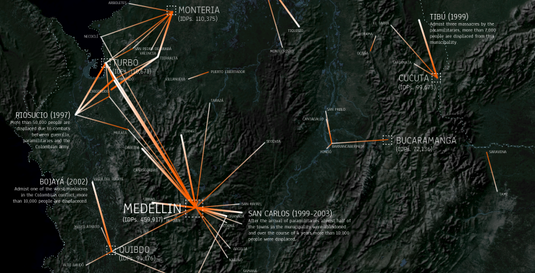
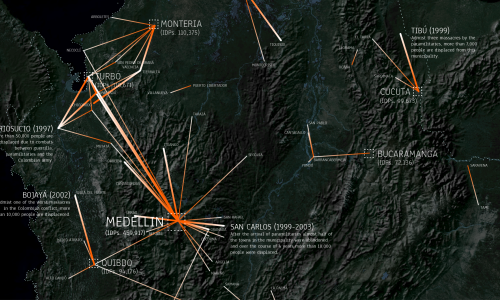
On the eve of an historic and controversial peace agreement in Colombia we have launched an investigation into the spatial characteristics of the decades long conflict between multiple state and non-state actors in the country. We have provisionally titled this research Conflict Urbanism: Colombia. We analyze and visualize the documented aspects of the conflict in Colombia in order to put forward policy recommendations for the transitional justice and peacebuilding process.
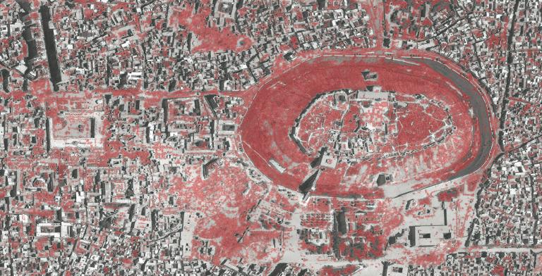
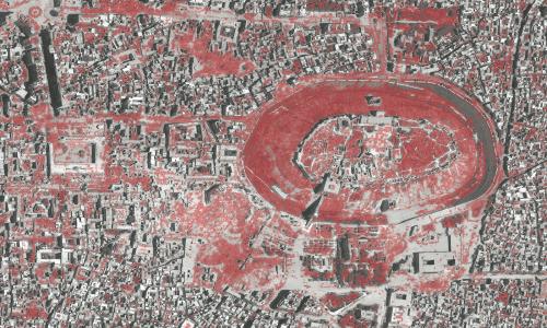
Conflict Urbanism: Aleppo is a call for inquiry and a call to action. It is an open-source, interactive, data-rich map of the city of Aleppo, at the neighborhood scale. Users can navigate the city, with the aid of high resolution satellite imagery from before and during the current civil war. It is also an invitation to students and other collaborators to record and narrate urban damage in Aleppo — at the cultural, infrastructural, or neighborhood scale — and to present that research in case studies which will be added to the website over time.
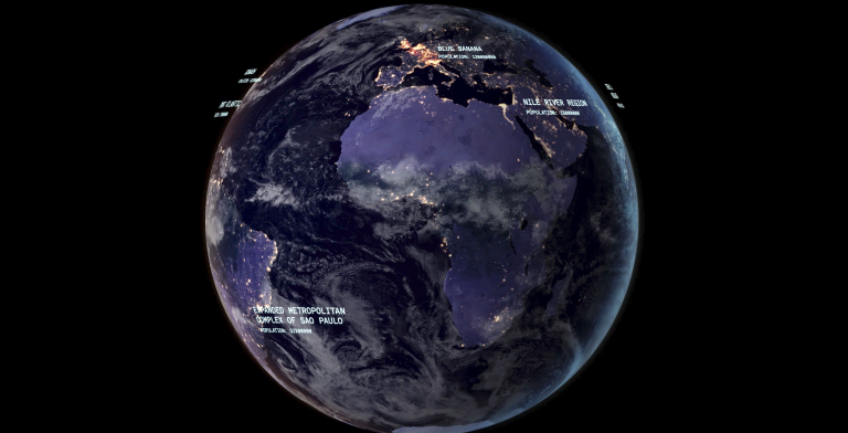
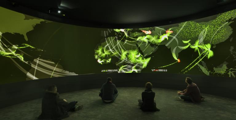
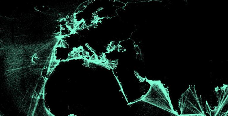
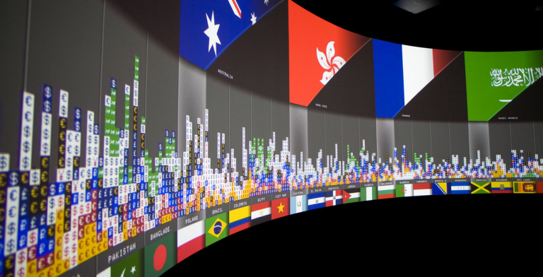
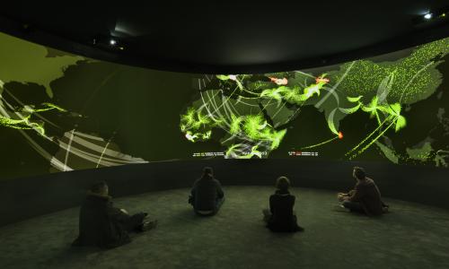
Exit is an immersive installation that investigates global human migrations. The maps are made from data which has been collected from a variety of sources, geocoded, statistically analyzed, re-processed through multiple programming languages and translated visually. Updated to coincide with Cop21 it was exhibited at Palais Tokyo from November 25, 2015 – January 10, 2016.
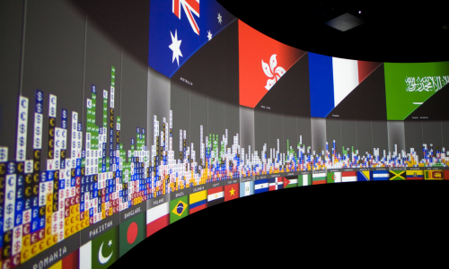
Exits, a panoramic multi-media installation which was on view at the Cartier Foundation in Paris, France from November 2008 – March 2009 as part of “Elsewhere starts here,” conceptualized by Paul Virilio. The project was part of a larger exhibition, Terre Natale: Stop Eject.
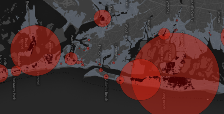
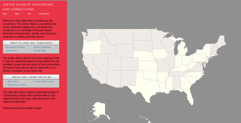
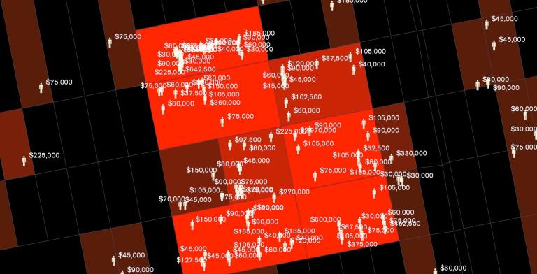
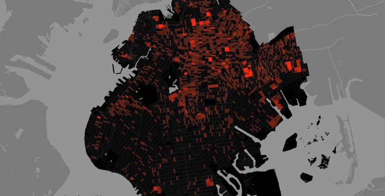
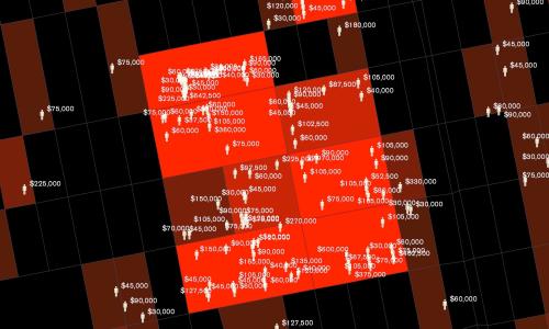
The United States currently has more than two million people locked up in jails and prisons. A disproportionate number of them come from a very few neighborhoods in the country’s biggest cities. In many places the concentration is so dense that states are spending in excess of a million dollars a year to incarcerate the residents of single city blocks. Using rarely accessible data from the criminal justice system, the Spatial Information Design Lab and the Justice Mapping Center have created maps of these “million dollar blocks” and of the city-prison-city-prison migration flow for five of the nation’s cities.